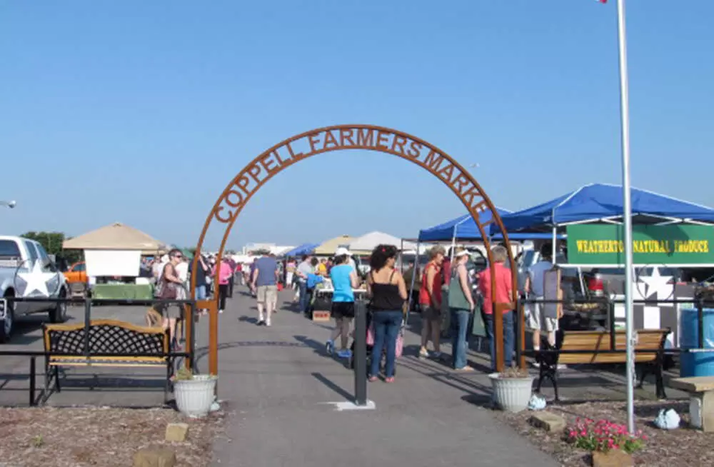
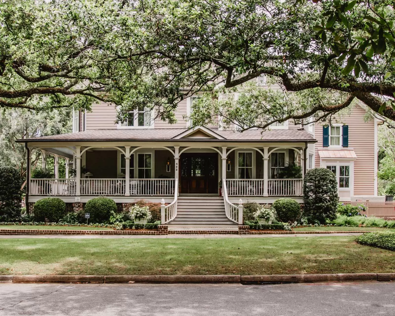
COMMUNITIES

Learn about each of the areas that make North Texas unique.

Addison

Addison is in the heart of the Dallas-Fort Worth Metroplex, just north of Dallas proper. It's a center for business in the metro area, yet it maintains a close-knit neighborly atmosphere. Addison has excellent municipal services, such as a city-wide wireless Internet network, along with outstanding parks and recreation programs, adding to the city's charm. The area is within 20 minutes from downtown Dallas and has easy access to major highways within the city.


As of the census of 2010, there were 13,056 people, 7,378 total households, and 2,663 family households residing in the town. The population density was 3,200.0 people per square mile (1,234.7/km2). There were 8,205 housing units at an average density of 1,853.4 per square mile (715.1/km2). The racial makeup of the town was 67.79% White, 9.63% African American, 0.41% Native American, 7.81% Asian, 0.11% Pacific Islander, 10.79% from other races, and 3.46% from two or more races. Hispanic or Latino of any race were 24.04% of the population. There were 7,378 households, out of which 14.3% had children under the age of 18 living with them, 24.5% were married couples living together, 8.2% had a female householder with no husband present, and 63.9% were non-families. 52.2% of all households were made up of individuals, and 10.2% had someone living alone who was 65 years of age or older. The average household size was 1.77 and the average family size was 2.69.


In the town the population was spread out, with 14.5% under the age of 18, 11.6% from 18 to 24, 43.9% from 25 to 44, 22.6% from 45 to 64, and 7.2% who were 65 years of age or older. The median age was 32.5 years. For every 100 females, there were 99.4 males. For every 100 females age 18 and over, there were 99.1 males.

Detail Photo Here

Dallas

Dallas is the epicenter of the Dallas-Fort Worth Metroplex and one of the business and cultural hubs in all the United States. In just the past 20 years, Dallas has been the scene of explosive growth in upper-scale lofts, apartments and condominiums, catering to upwardly mobile young professionals who crave access to art, culture, great food and entertainment. Dallas is home to some of the best public schools in the nation as well as to the NBA's Dallas Mavericks and the NHL's Dallas Stars.

Detail Photo Here

Coppell

Coppell is a small city in the northwest part of Dallas County, located in the heart of the Dallas-Fort Worth Metroplex. This bedroom community has one of the highest median household incomes in the region, and its homes are usually large brick homes, many bordering creeks and lakes in new developments. Coppell is served by an exemplary school district that features one of the consistently best-rated music programs in the country.

Detail Photo Here

Carollton

Carrollton sits in the northern crest of Dallas but rests within three counties in the Dallas-Fort Worth Metroplex, including Denton, Dallas and Collin counties. The city has been recognized multiple times by multiple publications as one of the best places to live among small cities. Families relocating to the D/FW Metroplex will love the affordability of homes in this area and its access to big city amenities.

Detail Photo Here

Frisco

Frisco is a booming city, part of the Dallas-Fort Worth Metroplex, and the fastest-growing city in the country as of 2009, according to U.S. Census Bureau data. From an old town area to golf course lots and country homes on acreage, to resale and new construction by nationally known home builders, there is a multitude of housing styles and price ranges available. Frisco is also home to Major League Soccer's FC Dallas and will soon be the headquarters for the NFL's Dallas Cowboys.

Detail Photo Here

Allen

Allen is a medium-sized city in Collin County just north of Dallas, Texas, and it's one of the fastest-growing communities in the state. It's far enough away from the Metroplex to provide a comfortable, small-town environment yet close enough to take advantage of everything the big city has to offer. Homes are available at a wide range of prices, and the city is well-planned for growth. The city of Allen is known for its pro-business climate, but it might be best known for its high school stadium, a $60M structure that is undergoing repairs in 2014.

The Allen area was previously home to the Caddo, Comanche, and other indigenous peoples. The first immigrants from the United States and Europe arrived in the early 1840s. The town was established by the Houston and Central Texas Railroad and named in 1872 for Ebenezer Allen, a state politician, and railroad promoter. The railroad allowed the sale of crops across the country before they rotted, causing a shift from the previous cattle-based agriculture. On February 22, 1878, a gang led by Sam Bass committed in Allen what is said to be Texas's first train robbery.

From 1908 through 1948, Allen was a stop along the Texas Traction Company's interurban line from Denison to Dallas. Allen was a small town of a few hundred residents when it was incorporated in 1953. Since this time, it has grown dramatically due to the construction of U.S. Route 75, the Dallas/Fort Worth International Airport, and the development of nearby Dallas and Plano. Among the more recent developments in the Waterford Parks neighborhood.

Detail Photo Here

McKinney

McKinney has been one of the fastest-growing cities in the country over the past 15 years. The county seat of Collin County is about a half-hour to the north of Dallas and is a community that offers everything from great golfing to hiking, biking and much more. Homes surround the city's numerous lakes and golf courses. There are plenty of middle- to upper-tier homes from which to choose, and the city was recognized in September 2012 by CNN's Money magazine has being the second-best place to live in the United States.

Detail Photo Here

Plano

Plano is a key part of the Dallas-Fort Worth Metroplex and home to at least a dozen major corporate headquarters from Frito-Lay to J. C. Penney and Toyota Motors USA. Three times Plano has been recognized as the best place to live in the western United States, and Forbes deemed it the safest city in America in both 2010 and 2011. Prospective residents often seek out Plano homes due to its fabulous public school system. Plano homes for sale usually do not last long because of their high demand and their tasteful designs.

Detail Photo Here

Prosper

Prosper is -- as its name might suggest -- a prosperous upscale suburb in Collin and Denton counties, north of the Dallas-Fort Worth Metroplex. Beautiful upper-scale homes are built in the area, but it's far away enough from the big city to maintain its country characteristics. You'll love the view of beautiful farms, ranches, and the natural beauty that make Prosper perfect for country living.

Detail Photo Here

Celina

Celina is a small town (pop. 6,028) in both Collin and Denton counties in north Texas, but it's a town on the move having grown by more than 200 percent the past decade and a half. Nevertheless, Celina is a community that maintains all its country charm, located on state Highway 289 and Farm Road 455, 15 miles northwest of McKinney and 12 miles north of Frisco. Celina is a hotbed of residential development, too, with many middle- to upper-scale homes from which to pick.

Detail Photo Here

Irving

Irving and Las Colinas, Texas, are communities in the Dallas-Fort Worth Metroplex sought out by home buyers for their business climates and proximity to DFW Airport. Technically a suburb of Irving, Las Colinas was one of the first master-planned communities in the United States, and it's home to three premier country clubs. The area boasts a wealth or art, culture, and sports opportunities and beautiful, private residential communities in Irving. Irving is also home to the PGA's annual Byron Nelson Golf Classic.

Detail Photo Here

Highland Village

Highland Village is north of Dallas by about 30 minutes, and it's part of one of the most quickly growing areas in the region, Denton County. A family-oriented environment for middle- to upper-income families, Highland Village is particularly attractive for professionals who love access to the water as it's right on the edge of Lewisville Lake.

Detail Photo Here

Flower Mound

Flower Mound is a city located in Denton and Tarrant counties within the Dallas-Fort Worth Metroplex. The city saw a massive housing boom after the construction of DFW Airport in 1974 and has been a coveted community for home buyers ever since thanks to its well-built, affordable middle- and upper-scale homes. Recreational enthusiasts will love Lake Grapevine and Lake Lewisville as well all the wooded hills and panoramic views in the area.

Detail Photo Here

Richardson

A combination of great schools and an expanding list of amenities is bringing more people to Richardson. Richardson is an affluent inner suburb of Dallas and home of The University of Texas at Dallas (UTD) and the Telecom Corridor® with a high concentration of telecommunications companies. More than 5,000 businesses have operations within Richardson's 28 square miles Richardson is one of the most conveniently located communities in the Metroplex, with access to points in all directions via both major roadways and the DART rail system.

Detail Photo Here

Southlake

Schools and convenience to all things Dallas/Fort Worth, including the airport, is part of the draw to Southlake. It’s a popular executive relocation town, balancing sophisticated living with a neighborly community. Southlake, Texas provides the perfect oasis from the frenzy of Dallas/Fort Worth with premier urban planning and attention to the smallest details.

Detail Photo Here

Keller

Keller is located in the heart of the Dallas/Fort Worth Metroplex with easy access to major business and activity centers. Keller has extensive amenities, which include parks, miles of hike and bike trails along meandering creeks, and in-line hockey, soccer, volleyball, basketball and baseball fields. Located nine miles east of the city and one of the busiest airports in the nation, DFW International Airport provides access to anywhere in the United States as well as throughout the world.

Detail Photo Here

Fort Worth

Fort Worth is the 16th-largest city in the United States and the fifth-largest city in the state of Texas. The city is in North Central Texas and covers nearly 350 square miles in the counties of Denton, Parker, Wise, and Tarrant. The city is the second-largest in the Dallas–Fort Worth–Arlington metropolitan area (the "DFW Metroplex"). The City of Cowboys and Culture welcomes visitors from around the world to experience the great American West and rich arts and culinary treasures. Fort Worth is located minutes from AT&T Stadium and DFW International Airport. As one visitor says, "unpretentious, laid-back, and charismatic in all the right ways." Fort Worth is comprised of seven primary entertainment districts each offering distinct dining, shopping, entertainment, and cultural amenities. In only a few days you can enjoy a range of experiences: from NASCAR racing to rodeos, world-class museums to cowboy cuisine, boutique shopping to a Top 5 zoo, biking to horseback riding.

Detail Photo Here

Rockwall

Thirty minutes from downtown Dallas (in good traffic), on the far shore of Lake Ray Hubbard, lies the little city of Rockwall, Texas. Rockwall offers many different sports complexes as well as activities. For example, Lake Ray Hubbard has several boating marinas and is used for jet skiing and also offers 22 different Golf Courses within 17 miles of the center of Rockwall.

Detail Photo Here

Little Elm

Little Elm is a city in Denton County, Texas, United States, and a part of the Dallas-Fort Worth Metroplex. Located along the shores of Lake Lewisville, Little Elm is truly a “Town with a lake attitude.” Little Elm sits in the middle of I-35, U.S. highway 380, the North Dallas Tollway and the Sam Rayburn Tollway, so transportation to other parts of the Metroplex is a breeze. Little Elm is located within five miles of professional sports facilities, 10 miles to major employment centers, 10 miles to regional shopping destinations and 35 miles to downtown Dallas. Living in Little Elm places you conveniently close to anything you may need in the DFW region.

Detail Photo Here

Garland

Garland is a city in the U.S. state of Texas. It is located northeast of Dallas and is a part of the Dallas–Fort Worth metroplex. It is located almost entirely within Dallas County, except a small portion located in Collin and Rockwall counties

Detail Photo Here

Arlington

Arlington is a city in Texas, west of Dallas. It's home to the University of Texas at Arlington (UTA), whose campus has a modern planetarium. In River Legacy Parks, trails cut through hardwood forests rich in wildlife. The park also has the River Legacy Living Science Center, with aquariums, terrariums, and interactive exhibits. The Dallas Cowboys football team plays at AT&T Stadium, which also hosts concerts.

By 1925 the city's population was estimated at 3,031—well under the population of Dallas and Fort Worth at the time. In 1929, a horse-racing track called Arlington Downs was constructed by W.T. Waggoner close by to the speakeasy. Gambling was still illegal, but people were making bets regardless. Waggoner and his sons campaigned to make parimutuel betting legal, and in 1933 the state issued its first legal gambling permit to Arlington Downs. The track was immensely profitable at that point, making a daily average of $113,000 before inflation with a daily attendance average of 6,700 people. At the end of the 1937 season, the state legislature repealed their parimutuel gambling laws, and the Downs were sold to commercial developers.

In the 1940s, the Arlington Downs was used as a rodeo and event venue. Top O' Hill Terrace evaded the police until 1947 when famous Texas Ranger M. T. "Lone Wolf" Gonzaullas caught the gambling operation in full swing and had the place shut down. The 1940s brought World War II to the forefront of the United States, and many families from around Texas moved to Arlington to find jobs. Before World War II, the city's population had grown to over 4,000. The war kick-started a manufacturing revolution in Texas. Arlington was between the biggest aerospace engineering hubs in Texas at the time, Dallas and Fort Worth.

Detail Photo Here

Mesquite

Mesquite prospered through the late 19th and early 20th centuries as a farming community, growing cotton, hay, corn, and sugar, and using the railroad to ship raw goods. The town remained predominantly agrarian until after World War II, when the suburban boom took root in Mesquite.

In 1946, the Mesquite Rodeo was founded by Charlie Columbus McNally, and was one of the only rodeos that had a permanent location. By the mid-1980s, the events were being broadcast by ESPN.

In 1959, Big Town Mall opened as the first air-conditioned shopping mall in the United States. The mall was demolished in the summer of 2006, and FedEx opened a logistics center on the property in 2017.

By 1970, the LBJ Freeway (I-635) was constructed, connecting Mesquite to its neighbors, Garland to the north and Balch Springs to the south. Also, in 1971, Town East Mall was constructed. The mall was used by director Ron Howard to film portions of the movie Cotton Candy in 1978. The mall's associated traffic and shops would continue to grow the town.

In 1986, the Mesquite Arena opened its doors as the new home for the Mesquite ProRodeo. By 1998, the facility was expanded to include a convention center, exhibition hall, and a Hampton Inn and Suites.

By the 1990 census, the city had grown to 101,484 people, up from 1,696 residents in 1950.

In 2011, Mesquite passed a law allowing beer and wine sales in the city. The measure had been considered several times for many years, but was always blocked by strong protest against the proposed sales. It was one of the few cities without beer and wine sales in eastern Dallas County before the law came into effect.

In June 2015, the Mesquite Arts Center added a Freedom Park exhibit, in memorial of September 11. The park displays a 15-foot (4.6 m) beam that was recovered from the remains of Ground Zero. The Mesquite Fire Department received the beam in 2011

Detail Photo Here

The Colony

The Colony derives its name from the original Peters Colony. The Peters Colony headquarters was located within the current boundaries of The Colony in the historical community of Stewartsville and the site of the Hedgcoxe War.The Colony is also the site of Bridges Settlement (established during the years of the Republic of Texas and the oldest community in Denton County), Stewarts Creek, Rector, Stoverville and Camey, also known as Camey Spur.

The Colony did not exist before 1973, when home developers Fox and Jacobs (since purchased by Centex) purchased 3,000 acres of land located around State Highway 121 and Farm to Market Road 423. The name "The Colony" was chosen by Fox and Jacobs because they wanted its new development to share a sense of kinship with Texas' early history and "to create a living monument to the spirit and courage of the Peters Colonists ... those men and women who braved considerable hardships to begin new lives, in new homes, on new land." They planned the development to be a new "dream city" consisting primarily of single-family homes grouped as a "colony" and based on the city of Dallas' infrastructure specifications, In 1973, Fox and Jacobs negotiated an agreement with the city of Frisco to begin construction in its extraterritorial jurisdiction. In 1974, street construction began with many streets being named after early settlers and members of the construction crews. The first model homes were completed in August 1974 and the first families moved into their homes in October that year. The homes were served for water services by The Colony Municipal Utility District formed in 1974, electricity via Texas Power and Light, cable television via Lakeside CATV and telephone service via Southwestern Bell.

In 1977, the homeowners associations' petition to disannex the development from the city of Frisco's extraterritorial jurisdiction was approved. The Colony voted to become an incorporated city in January 1977 and became a Home Rule City in 1979. Residents of The Colony participated in two polls to select a name for the new city. Both polls chose the name "The Colony" and the name was ratified by the City Council in May 1977. In 1987, The Colony voted to merge with the small lakeside community of Eastvale

Detail Photo Here

Grand Prairie

The city of Grand Prairie was first established as Dechman by Alexander McRae Dechman in 1863. Prior to then, he resided in Young County near Fort Belknap. The 1860 U.S. Federal Census - Slave Schedules shows an A McR Dechman as having 4 slaves, ages 50, 25, 37, and 10. Dechman learned that he could trade his oxen and wagons for land in Dallas County. In 1863, Dechman bought 239.5 acres (96.9 ha) of land on the eastern side of the Trinity River and 100 acres (40 ha) of timberland on the west side of the river for a broken-down wagon, oxen team, and US$200 in Confederate money. He tried to establish a home on the property but ran into difficulties, so he returned to his family in Birdville before joining in the Civil War. In 1867 he filed a town plat consisting of 50 acres (20 ha) with Dallas County.

After the war, he returned to Birdville for two years before selling that farm in 1867 and moving to Houston, where yellow fever broke out, causing the family to settle in Bryan. In 1876, Dechman traded half his "prairie" property to the T&P Railroad to ensure the railroad came through the town. The railroad named the depot "Dechman", prompting its namesake to relocate his home from Bryan to Dechman. His son Alexander had been living in Dechman and operating a trading post and farm. The first church in the area was the Good Hope Cumberland Sabbath School, established in 1870 by Rev. Andrew Hayter. The church was later renamed West Fork United Presbyterian Church and remains an active church.

The first U.S. post office opened in 1877 under the name "Deckman" rather than "Dechman", because the U.S. Postal Service couldn't read the writing on the form completed to open the post office. Later that same year, after the Postal Service had adopted the "Deckman" name, confusion resulted from the T&P Railroad designation "Grand Prairie". This name was based on maps drawn from around 1850 through 1858 that labeled the area between Dallas and Fort Worth "the grand prairie of Texas". In order to alleviate the confusion, the Postal Service named the post office "Grand Prairie".

The town of Grand Prairie was eventually incorporated as a city in 1909. During World War I and since, Grand Prairie has had a long history with the defense and aviation industry. While the present-day Vought plant on Jefferson Avenue is part of a small strip within the Dallas city limits, it was originally in Grand Prairie. During World War II the North American Aviation Plant B produced the Consolidated B-24 Liberator and the P-51C and K Mustang variants. After the war, Vought Aircraft took over the plant. This later became Ling Temco Vought (LTV) and then eventually returned to the Vought moniker. The plant was the production site for the F-8 Crusader and the A-7 Corsair II aircraft of the 1950–1989 time period. The LTV Missile and Space division produced missiles such as the Scout and MLRS. This division was eventually sold to Lockheed Martin, which continues to operate in Grand Prairie. Grand Prairie was also the North American headquarters for Aérospatiale Helicopter. This company eventually became Airbus Helicopters, Inc., the U.S. subsidiary of Airbus Helicopters.

In 1953, the mayor and city council of Grand Prairie attempted to annex nearly 70 square miles (180 km2) of then-unincorporated and largely undeveloped land in southern Dallas and Tarrant counties. Vehement debate ensued, and the legal pressure from cities like Arlington, Duncanville, and Irving wound up overturning part of the annexation attempt.

Detail Photo Here

Farmers Branch

The community was first settled in the early 1850s. In 1842, Thomas Keenan, Isaac B. Webb, and William Cochran received original land grants in the area. By 1843, a community called Mustang Branch had been established. Mr. Cochran later changed the name to Farmers Branch to reflect the area's rich soil and farmland. Farmers Branch was the first location of the Texan Land and Emigration Company (or Peters Colony) in 1845. This made the community one of the best-known places in Dallas County during the 1840s because of its advertising throughout Europe and the United States. Baptist minister William Bowles opened a blacksmith shop and gristmill in 1845. On May 5, 1845, Isaac B. Webb donated land for Webb's Chapel Methodist Church, the first formal place of worship in Dallas County. A school was established in the church one year later. Webb became the first postmaster at the Farmers Branch post office, which opened on January 5, 1848. It continued to function until its closure in 1866. The post office reopened in 1875. To assure that railroads would eventually pass through Farmers Branch, prominent early settler Samuel Gilbert and others sold right-of-way through their land in 1874. Around three to four years later, the Dallas and Wichita Railway completed a track from Dallas – through Farmers Branch – to Lewisville. It was absorbed by the Missouri–Kansas–Texas Railroad in 1881. The community had a population of approximately 100 by 1890 with several businesses. The population had grown to 300 during the early 1900s. A brick school building was constructed in 1916. The number of people living in the community remained stable until after World War II.

Farmers Branch was incorporated as a city after an election was held on February 23, 1946.[9] William F. (Bill) Dodson was elected as the city's first mayor. The implementation of city services began immediately after incorporation. In the 1950 census, Farmers Branch had a population of 915. In 1956, a home rule charter was approved that adopted a council-manager form of government. The rapid growth of the city during the 1950s was made apparent in the 1960 census, which recorded a total of 13,441 residents, a 1,369 percent increase over the 1950 figure. Most of the new residents commuted to nearby Dallas for employment. The population topped 27,000 by 1970. A variety of manufacturers producing items such as steel products, concrete, asphalt, cosmetics, and food products were operating in the city. The number of residents declined to 24,863 in 1980 and 24,250 in 1990. The falling population was offset, however, by the wide variety of businesses located in the city. Farmers Branch is home to a large number of corporations that have attained frontage along Interstate 635, the Dallas North Tollway, and Interstate 35E. Its Dallas North Tollway segment is part of the Platinum Corridor, and its land along Interstate 635 is an extension of the lengthy Irving Prairie office park. By 2000, the city's population had grown to 27,508.

Detail Photo Here

Rowlett

Rowlett is a city in Dallas and Rockwall counties in the U.S. state of Texas, and an eastern suburb of Dallas. The population was 66,285 as of the 2018 Census est. It is a growing, upscale community with nearly $1.5 billion in development in the Dallas–Fort Worth metroplex, located on Lake Ray Hubbard

Detail Photo Here

Abe's Landing

Abes Landing is a beautiful community on the Northside of Granbury. This community started out as a privately owned ranch operation. Now it is home to an impressive list of amenities including one of a kind clubhouse, community pool, and private boat slips.

Granbury is a city and the county seat of Hood County, Texas, United States. As of the 2010 census, the city's population was 7,978, and it is the principal city of the Granbury micropolitan statistical area. Granbury is located 35 miles (56 km) southwest of Fort Worth, Texas.

Granbury started as a square and log cabin courthouse. Many of the buildings on the square are now registered historic landmarks, including the Granbury Opera House, which still hosts "Broadway" productions. The city name originated from Confederate General Hiram B. Granberry. To explain why the city name is spelled differently, some scholars believe the name Granberry was misread on a document. Still, recent findings have concluded that Granberry chose to spell his name Granbury.

A recent expansion of the city was made possible by building a Brazos River dam in 1969, which formed Lake Granbury, a long, narrow lake that flows through the city.

Granbury and Hood County are rich in Texas history. David (Davy) Crockett's wife, Elizabeth, settled in Hood County in 1853 following the Texas Revolution against Mexico. Crockett, as well as other Alamo participants, received 640 acres in land grants. The Crockett family received land in what is now Hood County. Elizabeth Crockett is buried in Acton State Historic Site, the smallest state park in Texas. A large statue of Elizabeth Crockett marks her gravesite. Several of Crockett's descendants still reside in Hood County.

Detail Photo Here

Pecan Plantation

Pecan Plantation is a unique gated community located on 3,000 acres embraced by the Brazos River just below the Lake Granbury dam. Pecan Plantation is not too close and not too far from the Metroplex at only 35 miles from Fort Worth. Much of the property is a working pecan orchard. Wildlife galore abounds within our borders, where it is not uncommon to see deer every day. There are many amenities to enjoy, Security gates at both entrances are staffed from 7 a.m. until midnight daily and after-hours are continually monitored by staff. Our classically beautiful country club offers full dining services from casual dining options to fine cuisine, with banquet specialists and facilities for catered events from the most formal to relaxed down-home gatherings. Our championship-level golf course will appeal to golfers of every level. We offer a six-court tennis complex and a recreation center with classes, a game room, a walking trail, and a gymnasium, where classes and activities are available for young and old alike. Our aquatics program offers two pools with swim classes and water exercise classes available in the summer. Pooch Plantation, our off-leash dog park, is the place for furry friends to play and make friends. Three beach/park areas are located along the Brazos River inside the community. Pecan’s marina is on Lake Granbury and has boat slips for rent along with a store and a grill serving lunch every day. There are also nature trails, an archery range, an equestrian area with stables, and much, much more

Detail Photo Here

De Cordova Bend

DeCordova Bend Estates is a gated golf course community located near Granbury, Texas, and just 45 minutes from downtown Fort Worth, Texas. The aerial view of DeCordova Bend Estates and Lake Granbury captures the expansive shoreline, the main golf course and tennis courts as well as numerous waterfront and water view residences that make the rolling hills of DeCordova a popular choice for newcomers.

Detail Photo Here

Indian Harbor

Located on the west side of Lake Granbury, just outside the city limits of Granbury, off Highway 144 and only 12 miles from Glen Rose. This makes Indian Harbor a very convenient place to live. Nestled in the hills and cedar trees gives you a feel of living in a state park. You get the quietness of living in the country next to a lake, but you are only 10 minutes from the charming town of Granbury, with its historical downtown square and the shops, entertainment, and fabulous dining. Indian Harbor’s amenities include a marina with boat slips, a clubhouse with a swimming pool, and the Teen Center. All these amenities are waiting for you in a country setting by the lake, with abundant waterfront homes on canals and the main body at lake level, and also in the cliffs.

Detail Photo Here

Catalina Bay

Catalina Bay on Lake Granbury is a sparkling Mediterranean gated community located just a few minutes from the center of Granbury, Texas and Highway 377. Offering an array of shopping choices, restaurants, and the Granbury movie theater, Catalina Bay is the perfect place for your dream home and an excellent investment in Lake Granbury Real Estate. With beautiful waterfront and an amazing location, Catalina Bay is among the most attractive communities in all of Granbury. Another factor that enhances Catalina Bay’s appeal is its incredible view of Comanche Peak, which in and of itself has become virtually synonymous with the city of Granbury, TX. In Catalina Bay, a variety of lots and residences alike are available including main body, canal front, as well as greenbelt. Catalina Bay is one of the newest and most highly regarded real estate in Granbury.

Detail Photo Here

Harbor Lakes

Harbor Lakes offers many historical, cultural, and recreational entertainment opportunities close by. This community is a wonderful place to live and to call home. Harbor Lakes Homeowners Association, Inc. is a Texas non-profit corporation. The association was established for the maintenance of the common areas and to provide architectural control and compliance with the covenants, conditions, and restrictions of the Declaration.

Detail Photo Here

Aledo

Aledo is a city in Parker County, Texas, United States. The population was 2,716 at the 2010 census. The city is served by the Aledo Independent School District.

At the 2000 census, there were 1,726 people in 601 households, including 494 families, in the city. The population density was 909.2 people per square mile (350.7/km2). There were 625 housing units at an average density of 329.2 per square mile (127.0/km2). The racial makeup of the city was 97.22% White, 0.29% African American, 0.41% Native American, 0.41% Asian, 0.58% from other races, and 1.10% from two or more races. Hispanic or Latino of any race were 2.55%. Of the 601 households, 49.1% had children under the age of 18 living with them, 67.1% were married couples living together, 12.6% had a female householder with no husband present, and 17.8% were non-families. 15.6% of households were one person and 4.8% had living alone who was 65 or older. The average household size was 2.87 and the average family size was 3.21.

The age distribution was 33.1% under the age of 18, 5.9% from 18 to 24, 34.4% from 25 to 44, 19.9% from 45 to 64, and 6.7% 65 or older. The median age was 34 years. For every 100 females, there were 89.7 males. For every 100 females age 18 and over, there were 90.3 males.

The median household income was $54,327 and the median family income was $56,897. Males had a median income of $41,193 versus $29,671 for females. The per capita income for the city was $21,664. About 1.4% of families and 2.3% of the population were below the poverty line, including 1.1% of those under age 18 and 6.6% of those age 65 or over.

Detail Photo Here

Weatherford

Weatherford is a city in and the seat of Parker County, Texas, United States. The 2010 United States Census stated the population as being 29,969.

Detail Photo Here

Wylie

Wylie is a city and northeastern suburb of Dallas, that was once solely located in Collin County but now extends into neighboring Dallas and Rockwall Counties in the U.S. state of Texas.

Detail Photo Here

Sachse

Sachse is a city in Collin and Dallas counties in the U.S. state of Texas and is part of the DFW Metroplex. A northeastern suburb of Dallas, the city population was 20,329, as of the 2010 census with an estimated population of around 25,000 people today.

Detail Photo Here

Azle

Azle is a small city west of Fort Worth in Parker and Tarrant Counties in the U.S. state of Texas. As of the 2010 census, the city population was 10,947. Azle is the home of the Azle Marching Green Pride marching band and the Fighting Azle Hornets. Azle is on State Highway 199, 16 miles (26 km) northwest of downtown Fort Worth, in the northwest corner of Tarrant County; the town extends partly into Parker and Wise Counties. According to the United States Census Bureau, the city has a total area of 8.8 square miles (22.9 km2), of which 8.8 square miles (22.8 km2) is land and 0.015 square miles (0.04 km2), or 0.20%, is covered by water.

The first recorded settlement at the site occurred in 1846, when James Azle Steward, a young doctor, moved into a log cabin built by a Dutchman named Rumsfeld. Other settlers came and established themselves near the local streams, Ash Creek, Silver Creek, and Walnut Creek. Steward helped establish the first cemetery, Ash Creek. The oldest graves there are those of Dave Morrison (1849–1874) and W. P. Gregg (1833–1874). The first post office opened in 1881, and the town took the name of O'Bar, in honor of the man who obtained the postal service. A short time later in 1883, the name was changed to Azle at the request of Steward, who donated the land for a townsite. The community's economy was based on agriculture. Several crops were grown, including wheat, corn, peanuts, sorghum, and cotton. Watermelons, cantaloupes, peaches, plums, and pears were also produced. Dairy farming became important in the early decades of the 20th century when local milk products were sold to creameries in Fort Worth. Azle's population grew steadily, and by 1920, the census recorded 150 residents. By 1933, State Highway 34 (later State Highway 199) had reached Azle from Fort Worth, greatly improving transportation between the town and the city. Also, Eagle Mountain Lake was formed by a dam on the Trinity River, east of Azle.

As of the census of 2000, 9,600 people, 3,716 households, and 2,701 families resided in the city. The population density was 1,170.8 people per square mile (452.0/km2). The 3,957 housing units averaged 482.6 per square mile (186.3/km2). The racial makeup of the city was 95.90% White, 0.22% African American, 0.66% Native American, 0.51% Asian, 0.02% Pacific Islander, 1.41% from other races, and 1.29% from two or more races. Hispanics or Latinos of any race were 4.20% of the population. Of the 3,716 households, 35.3% had children under the age of 18 living with them, 57.5% were married couples living together, 11.2% had a female householder with no husband present, and 27.3% were not families. About 24.0% of all households were made up of individuals, and 10.1% had someone living alone who was 65 years of age or older. The average household size was 2.54 and the average family size was 3.00.

Detail Photo Here

Abilene

Abilene is a city in Taylor and Jones counties in Texas, United States. The population was 122,999 at the 2019 census, making it the 27th-most populous city in the state of Texas. It is the principal city of the Abilene Metropolitan Statistical Area, which had a 2017 estimated population of 170,219. Abilene was incorporated soon after being founded in 1881 and residents began to set their sights on bringing the county seat to Abilene. In a three-to-one vote, they won the county election to do so. In 1888, the Progressive Committee was formed to attract businesses to the area, and in 1890 renamed itself as the Board of Trade. By 1900, 3,411 people lived in Abilene. In that decade, the Board of Trade changed its name to the 25,000 Club, in the hope of reaching a population of 25,000 by the next census. By 1910, though, the population had increased only to 9,204. Another group was formed, the Young Men's Booster Club, which became the Abilene Chamber of Commerce in 1914.

Several major projects of restoration and new construction: The Grace Museum and Paramount Theatre, and development of Artwalk in 1992, sparked a decade of downtown revitalization. In 2004, Frontier Texas!, a multimedia museum highlighting the history of the area from 1780 to 1880, was constructed. That year an $8 million, 38-acre (150,000 m2) Cisco Junior College campus was built at Loop 322 and Industrial Boulevard.

Simultaneously, subdivisions and businesses started locating along the freeway, on the same side as the CJC campus. This area attracted Abilene growth on the Loop. Abilene has become the commercial, retail, medical, and transportation hub of a 19-county area more commonly known as "The Big Country", but also known as the "Texas Midwest". It is part of the Central Great Plains ecoregion. By the end of 2005, commercial and residential development had reached record levels in and around the city.

Detail Photo Here

Grapevine

Grapevine's story began in 1843 when General Sam Houston and representatives of the Republic of Texas met with members of 10 American Indian nations. They joined to negotiate a treaty of peace and friendship at Grape Vine Springs, also known as Tah-Wah-Karro Creek. It resulted in a document, the Treaty of Birds Fort (because they met at nearby Birds Fort), which opened the area to homesteaders. Within a year, the first settlers started arriving, rolling in on covered wagons, on the Grape Vine Prairie. The wild mustang grapes that were abundant there gave the area its name, Grapevine. Grapevine is the oldest settlement in Tarrant County, originating under the Lone Star flag of the Republic of Texas in 1844, a year before Texas was annexed by the United States of America. 

Today, the city has grown into a thriving center of culture and commerce, anchored by the Grapevine hospitality industry. Venues such as the buildings along 

Detail Photo Here

Mansfield

The first wave of European settlers arrived in the rolling Cross Timbers country of north central Texas in the 1840s. Primarily of Scotch-Irish origins, these pioneer farmers came for the most part from southern states, following the frontier as it shifted west of the Mississippi. They entered an area where Native Americans had been living for thousands of years. The Comanche posed a serious threat to the settlers, and in 1849, the U.S. Army established Fort Worth to protect the farms along the sparsely populated frontier.

The area southeast of the fort (and of the Trinity River) was well protected and presumably fairly well settled by the early 1850s. In one well-documented case, eight related families migrated to the area in 1853 from Illinois. Three of the four Gibson brothers in this group established homesteads about 4 miles (6 km) northwest of present-day Mansfield. This settlement, which became known as the Gibson Community, included a school and a church building by 1860.

When R.S. Man and Julian Feild arrived around 1856 and built a grist mill at the crossroads that was to become the center of Mansfield, the beginnings of the community probably existed in the oak groves bordering Walnut Creek (originally called Cedar Bluff Creek). The Walnut Creek Congregation of the Cumberland Presbyterian Church had organized itself in 1854. Members met in each other's homes, so it is suspected that there was a cluster of houses in the area.

In 1856, Julian Feild purchased 540 acres (2.2 km2) in the Mansfield area. Man and Feild completed their three-story brick grist mill sometime between 1856 and 1859. The mill, which produced flour and meal, was the first built in North Texas to utilize steam power and enjoyed patronage as far south as San Antonio and as far north as Oklahoma. The location of the mill in southeastern Tarrant County perhaps reflects the advanced state of wheat cultivation in the area and the ready availability of wood to feed the mill's steam boilers.

Feild opened a general merchandise store at the same time as the mill, located across Broad Street. He built a log house for his family, which also served as an inn for travelers and customers. By 1860, the nucleus of the future city existed. The first post office was established that year, with Julian Feild as postmaster.

During the American Civil War, the Man and Feild Mill supplied meal and flour to the Confederate States Army, hauling it to Shreveport, Louisiana, and Jefferson City, Missouri. As was common practice, the owners tithed ten percent of the mill's production to the Confederacy. The small community around the mill was unique in Tarrant County in that it prospered throughout the Civil War. "Feild's Freighters", assembled in ox-drawn wagon trains, went as far as Fort Sill, Oklahoma, where a part of the Indian Wars raged in the southern plains in the late 1860s and 1870s.

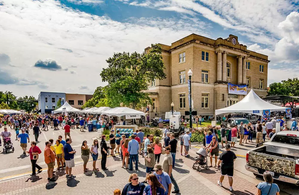
The prospering community which had grown up around the Man and Feild mill took on the name of "Mansfield", a combination of the names of the founders. Repeated misspellings over the years resulted in the acceptance of the conventional spelling of "Mansfield." The town was incorporated in 1909, continuing to be a hub for the surrounding farmland.

In 1956, a federal court ordered the Mansfield Independent School District to desegregate; the first such order in Texas. Protests by 300 whites in front of Mansfield High School, to prevent three black students from enrolling, touched off one of the longest-running desegregation battles of the Civil Rights Movement. Mansfield's school was quietly desegregated in 1965 as it faced a lack of federal funds.

Detail Photo Here

Saginaw

Saginaw (frequently known as Eagle Mountain–Saginaw) is a small city in Tarrant County, Texas, United States, and an inner suburb of Fort Worth. The population was 21,899 in 2017. Saginaw is a Home rule municipality. The town was renamed Saginaw in 1882 by Jarvis J. Green (after his first choice of "Pontiac" was rejected by the United States Postal Service), who had lived and worked on Saginaw Street in Pontiac, Michigan. The name Saginaw comes from the Ojibwe language and means "to flow out." It is also the name of a river, a bay, and a city in Michigan.

Detail Photo Here

Tyler

Tyler is a city in eastern Texas. It's known as a center for rose cultivation. In season, thousands of rose bushes line the manicured grounds of the Tyler Municipal Rose Garden. The Tyler Rose Museum explores the history of the city’s annual Texas Rose Festival. Housed in an 1859 mansion set in landscaped LeGrand Park, the Goodman Museum features antique furnishings and Civil War–era medical artifacts.

Detail Photo Here

Anna

Anna is a city in Collin County, Texas, United States. The population is 14,243 at the 2018 Census. Anna is located in northern Collin County at 33°21°01°N 96°33°03°W. The U.S. Route 75 freeway passes through the west side of the city and leads 45 miles southwest to the center of Dallas and 32 miles north to Denison. According to the United States Census Bureau, the city of Anna has a total area of 14.1 square miles, of which 14.1 square miles is land and 0.1 square miles, or 0.46%, is water. According to the City of Anna website, the city has a total area of approximately 15 square miles in its city limits and approximately 60 square miles in its planning area. The climate in this area is characterized by relatively high temperatures and evenly distributed precipitation throughout the year. The Köppen climate classification system describes the weather as humid subtropical, Cfa.

Detail Photo Here

Melissa

Some of Melissa's first settlers came from the old Highlands community, two and a half miles north of present-day Melissa. C.H. Wysong was one of the earliest settlers. A post office was established in 1853. The Houston and Texas Central Railroad was built in Melissa in 1872. The town was laid out at this time. The railroad encouraged many families to come to Melissa. The town is believed to have been named for the daughter of a railroad executive, George A. Quinlan (1838–1901) of the Houston and Texas Central Railroad. There is some disagreement about this, as others argue that the town was named after Melissa Huntington, daughter of C. P. Huntington, another well-known railroad executive. Anna, Texas, is named after Anna Elizabeth Quinlan (1878–1952), the only daughter of George Austin Quinlan and his wife Mary Kate Saunders (1851–1884). Quinlan, Texas, is named after George Austin Quinlan himself.

 The first school in Melissa was built on land purchased in 1882 by trustees James Graves, John Gibson, and George Fitzhugh, who were early settlers of the area. The first teacher was Mary Huckerston, who taught there for five years. The school began with 38 pupils. Church services were held there for all faiths on Sundays. A two-story brick schoolhouse was built on this site in 1910 to accommodate the growth brought by the railroad.

Melissa was an important shipping point in the early 1900s. Corn, wheat, alfalfa hay, wood, and livestock were all sent out on the railroad.

A deadly tornado struck Melissa on April 13, 1921, killing 13 people and injuring many more. The tornado tore the roof off of the brick school building, but the children inside were not seriously injured. However, all churches in the town, three cotton gins, every business house except a bank, the post office, and the Houston and Texas Central railway station, were wrecked. The Waldon Hotel was lifted by the winds, turned halfway around, and thrown up against the school building.

Eight years later, on August 8, 1929, a fire burned down many of the buildings that had been rebuilt after the tornado. The population declined from a high of 500 in 1925 down to 285 in 1949.

Detail Photo Here

Van Alstyne

Van Alstyne was built in 1872, for settlers to be near the railroad stop of the Houston and Texas Central Railway.[4] The town was named for either William A. Van Alstyne, a civil engineer with the railroad, or for Marie Van Alstyne, a shareholder in the railroad company.[5] The town was incorporated in 1890. Per a Van Alstyne Leader newspaper article September 3, 2015 the Outlaw "Bushwhacker Bill" Wilson, on whom the Clint Eastwood movie The Outlaw Josey Wales is based, was murdered somewhere in the vicinity of either the intersection of Texas Hwy 5 and Prong Creek 1 mile North of Van Alstyne or South of Van Alstyne halfway to the old ghost town[6] of Mantua. A lot of movie buffs would likely be interested if this was marked somewhere in the town.

Detail Photo Here

Princeton

In the late 1870s, T. B. Wilson and his brother George began farming near the site of future Princeton. In 1881 the Missouri, Kansas, and Texas Railroad Company extended its line from Greenville to McKinney, passing through land owned by the brothers. The name "Wilson's Switch" was commonly used to designate the area. When residents applied for a post office branch, however, they learned that the name Wilson was already being used. The community then submitted the name "Princeton" in honor of Prince Dowlin, a landowner, and promoter of the town. This name was accepted, and a post office was established in 1888. In 1940, a camp of 76 cabins was built west of Princeton to house up to 400 migrant workers, who came to work during the onion and cotton seasons. In February 1945, the site became a prisoner-of-war camp for Germans prisoners captured during the Second World War. The local farmers paid the POWs to work on their farms. This operation continued for eight months. Under a special bill, the German prisoners were contracted to work on the City Park located across from the city hall. The park was built as a living memorial and shrine to those who served and died during World War II. The Community Park/WWII P.O.W. Camp is located at 500 West College Street.

Detail Photo Here

Red Oak

Red Oak is a city in Ellis County, Texas, United States. It is part of the Dallas–Fort Worth metroplex. The population was 10,769 at the 2010 census, up from 4,301 at the 2000 census. The North Central Texas Council of Governments projects that number to grow to 63,329 by the year 2030, as it is on the verge of explosive suburban growth. Red Oak was the exterior location for filming True Stories, directed by David Byrne of Talking Heads and released in 1986. One of the first settlers to this area was James E. Patton and his family in 1844. They settled in what is now known as Ovilla, Texas, located about two miles from Red Oak. Before Red Oak was given its name in 1849, it was known as Possum Trot due to the animal that lived there. The Missouri, Kansas and Texas Railroad began near the Red Oak area in 1884 and was completed in 1890. This railroad allowed people to travel to Dallas and Waco. In 1949, Red Oak became an incorporated town of Ellis, County.

Detail Photo Here

Tuscola

Tuscola is a city in Taylor County, Texas, United States. The population was 742 at the 2010 census. It is part of the Abilene, Texas Metropolitan Statistical Area. As of the census of 2000, there were 714 people, 273 households, and 202 families residing in the city. The population density was 971.2 people per square mile. There were 307 housing units at an average density of 417.6 per square mile. The racial makeup of the city was 97.20% White, 0.14% African American, 0.28% Native American, 0.14% Asian, 0.70% from other races, and 1.54% from two or more races. Hispanic or Latino of any race were 7.28% of the population. There were 273 households, out of which 37.4% had children under the age of 18 living with them, 61.5% were married couples living together, 10.6% had a female householder with no husband present, and 26.0% were non-families. 23.8% of all households were made up of individuals, and 12.8% had someone living alone who was 65 years of age or older. The average household size was 2.62 and the average family size was 3.08. In the city, the population was spread out, with 28.6% under the age of 18, 7.3% from 18 to 24, 27.9% from 25 to 44, 23.4% from 45 to 64, and 12.9% who were 65 years of age or older. The median age was 37 years. For every 100 females, there were 89.9 males. For every 100 females age 18 and over, there were 87.5 males. The median income for a household in the city was $38,068, and the median income for a family was $42,396. Males had a median income of $31,484 versus $21,845 for females. The per capita income for the city was $18,661. About 3.7% of families and 6.8% of the population were below the poverty line, including 5.5% of those under age 18 and 15.7% of those age 65 or over.

Detail Photo Here

Buffalo Gap

Buffalo Gap is an incorporated town in Taylor County, Texas, United States. It is part of the Abilene, Texas Metropolitan Statistical Area. The population was 464 at the 2010 census. It is the former county seat of Taylor County, having been supplanted in 1883 by the much larger Abilene to its north. Abilene won the referendum to be the county seat by a vote of 905-269. Buffalo Gap was settled at the site of a natural pass through which bison herds traveled. It was a point on the Great Western Cattle Trail. The community has a few restaurants and art handicraft shops and caters to tourists. Buffalo Gap is the home of the large Buffalo Gap Historic Village, open year-round to visitors.

Buffalo Gap is located at the intersection of Farm-to-Market roads 89 and 1235. It was established in 1857 and procured a post office in 1878. The Callahan Divide, a topographic boundary between the Brazos and Colorado river basins, crosses Buffalo Gap from east to west. Elm Creek once provided a watering hole for buffalo. The Buffalo Gap Highway (Farm Road 89) was surveyed in 1874 and followed the old Center Line Trail, which extended from El Paso to Texarkana on the Texas-Arkansas boundary. Another major road passed through Buffalo Gap in the direction of the abandoned Fort Phantom Hill north of Abilene. The road forked at Buffalo Gap; one branch led southwest to Pecos County, and the other south to Tom Green County, which includes the county seat of San Angelo. Taylor County history centered upon the gap in the Callahan Divide, where during the 1860s and 1870s, buffalo hunters made winter camp and transported their hides to Fort Griffin northeast of Abilene.

As of the census of 2000, there were 463 people, 194 households, and 140 families residing in the town. The population density was 201.7 people per square mile. There were 235 housing units at an average density of 102.4 per square mile. The racial makeup of the town was 96.76% White, 0.22% African American, 0.22% Native American, 0.22% Asian, 0.65% from other races, and 1.94% from two or more races. Hispanic or Latino of any race were 3.24% of the population. There were 194 households, out of which 29.4% had children under the age of 18 living with them, 53.6% were married couples living together, 16.0% had a female householder with no husband present, and 27.8% were non-families. 26.3% of all households were made up of individuals, and 10.8% had someone living alone who was 65 years of age or older. The average household size was 2.31 and the average family size was 2.77. In the town, the population was spread out, with 23.8% under the age of 18, 6.3% from 18 to 24, 23.1% from 25 to 44, 30.5% from 45 to 64, and 16.4% who were 65 years of age or older. The median age was 43 years. For every 100 females, there were 80.2 males. For every 100 females age 18 and over, there were 76.5 males.

Detail Photo Here

Clyde

Clyde is a city in Callahan County, Texas, United States. The population was 3,713 at the 2010 census, up from 3,345 at the 2000 census. It is part of the Abilene metropolitan statistical area. The first settlers came to Clyde around 1876. Mr. Shephard built a log cabin, the first residence, around this time. Many others soon followed. Among the first settlers were people such as R. J. Estes who came all the way from Fort Worth. When he first came, he didn't plan on staying. Mrs. Estes and he had stopped only to rest but soon decided to stay. In their quick decision to stay, they simply left their belongings under a tree while they traveled to get the rest of their belongings for their new home. All their belongings were still as they had left them when they returned a few months later. The railroad was prominent in Clyde. It started with only a boxcar, then later a station was added. Along with the railroad came more settlers, homes, and work. Soon a school was needed. The actual origin of the name "Clyde" is not known. Many believe it was named after a crew foreman. The man worked for the Texas and Pacific Railway Company. The company had a tent for the employees to get supplies. They would say, "Let's go up to Clyde's," not talking about the town, only the supply tent. Soon the railroad company would call their boxcar location "Clyde". The first post office soon followed. The first postmaster, Jesse L. Miller, was appointed on June 27, 1881.

Detail Photo Here

Abilene ISD

Abilene Independent School District is a public school district based in Abilene, Texas (USA). The district serves the cities of Abilene and Impact in northeastern Taylor County as well as the portion of Abilene that lies in southeastern Jones County. As of the 2009-10 school year, AISD enrolled 17,016 students in 2 High Schools, 2 Magnet High Schools, 4 Middle Schools, 15 Elementary Schools and numerous special and alternative campuses. The district's enrollment peaked, for the time being, in the late 1990s and early part of the new century as development in south Abilene began to sprawl ever outward, spilling into neighboring Wylie ISD and Jim Ned CISD. As the city continues to age, school enrollment seems to have stabilized, for now, around 17,000.

In 2011, the school district was rated "academically acceptable" by the Texas Education Agency. Forty-nine percent of districts in Texas in 2011 received the same rating. No state accountability ratings will be given to districts in 2012. A school district in Texas can receive one of four possible rankings from the Texas Education Agency: Exemplary (the highest possible ranking), Recognized, Academically Acceptable, and Academically Unacceptable (the lowest possible ranking).

Former Middle Schools

  • Franklin Middle School (Broncos) [absorbed into Mann & Craig Middle School in 2007]
  • Lincoln Middle School (Longhorns) [consolidated into Craig Middle School in 2007]
  • Jefferson Middle School (Coyotes) [absorbed into Madison & Clack Middle Schools in 2004]

Former Elementary Schools

  • Central Elementary School [closed 1976] Lamar Elementary School [closed 1966]
  • Milam Elementary School [closed 1980]
  • Fair Park Elementary School [closed 1984]
  • Travis Elementary School [closed 1984]
  • Crockett Elementary School [closed 2002]
  • Jones Elementary School [closed 2002]
  • Valley View Elementary School [closed 2003]
  • Alta Vista Elementary School [closed 2003]
  • Fannin Elementary School [closed 2012]
  • College Heights Elementary School [closed 2012]
  • Long Elementary School [closed 2016]

Former Childhood Schools (Pre-Kindergarten)

  • Locust Early Childhood
  • Woodson Early Childhood
  • Woodson Early Headstart
Detail Photo Here

Wylie ISD

Wylie Independent School District is a school district based in Wylie, Texas, United States and covers much of south-central Collin County. Wylie ISD serves most of the city of Wylie, including the city of St. Paul, a portion of the city of Murphy, and the Collin County portion of the city of Sachse. Enrollment has grown to just over 16,000 students. The average student-to-teacher ratio is 15:1 In 2009, the school district was rated "recognized" by the Texas Education Agency.

Detail Photo Here

Jim Ned ISD

Jim Ned Consolidated Independent School District is a school district based in Tuscola, Texas (USA). The district serves approximately 1,000 students in southeastern Taylor County, including the towns of Tuscola, Buffalo Gap, and Lawn. A small portion of northeastern Runnels County lies within the district. The district is named after Jim Ned Creek, which runs through all three towns. The creek is named after Jim Ned, who was an Indian cavalry scout for the US Army. Colt McCoy, the former starting quarterback for the Texas Longhorns who now plays for the NFL's Washington Redskins, graduated from the district's Jim Ned High School. In 2009, the school district was rated "recognized" by the Texas Education Agency.

Detail Photo Here

Clyde ISD

Clyde Consolidated Independent School District is a public school district based in Clyde, Texas (USA). Located in Callahan County, portions of the district extend into Shackelford, Jones, and Taylor counties. In 2009, the school district was rated "academically acceptable" by the Texas Education Agency.

Detail Photo Here

Lawn

Lawn is a town in Taylor County, Texas, in the United States. As of the 2010 census, the town population was 314. It is part of the Abilene, Texas Metropolitan Statistical Area. In the town, the population was spread out, with 27.2% under the age of 18, 6.2% from 18 to 24, 27.2% from 25 to 44, 24.6% from 45 to 64, and 14.7% who were 65 years of age or older. The median age was 39 years. For every 100 females, there were 101.7 males. For every 100 females age 18 and over, there were 91.8 males. The median income for a household in the town was $28,281, and the median income for a family was $29,625. Males had a median income of $25,000 versus $17,500 for females. The per capita income for the town was $13,347. About 15.2% of families and 19.8% of the population were below the poverty line, including 29.0% of those under age 18 and 7.3% of those age 65 or over.

Detail Photo Here

Ovalo

Ovalo is an unincorporated community in Taylor County, Texas, United States. Although it is unincorporated, Ovalo has a post office, with the ZIP code of 79541. The community is part of the Abilene, Texas Metropolitan Statistical Area.

Detail Photo Here

Make your next move your best move.